How rain can move mountains?A new research published in the peer-reviewed journal Science Advances revealed a surprising discovery that rainfall can contribute to moving mountains.
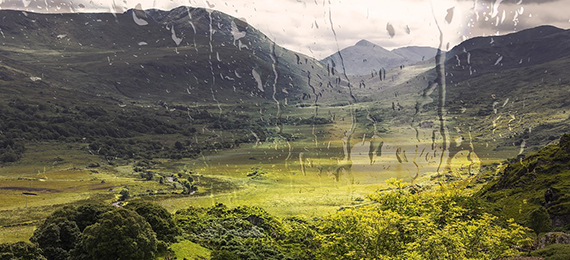
Rainfall has a dramatic effect on the evolution of mountainous landscapes. This concept is widely debated among many geologists. A new study led by the University of Bristol and published in Science Advances, talks about possible impact of climate change on landscapes, including how peaks and valleys have formed over millions of years.
Effects of Rainfall on Mountains
Dr. Byron Adams, a Royal Society Dorothy Hodgkin fellow at the University of Bristol’s Cabot Institute for the Environment, worked together with researchers from Arizona State University (ASU) and Louisiana State University for the study.
The U.S. National Science Foundation-Funded Research Was Published in the Journal Science Advances.
- A. True
- B. False
Thanks to this new technique which helps to capture precisely how rain can erode a landscape and pulls mountains up very quickly. They utilized cosmic clocks inside sand grains to measure the speed when rivers erode the rocks underneath them. Adams and Forte were part of the ASU.
Whipple Professor of Geology at ASU stated that “These findings are the latest outcome from a collaborative study that began several years ago at ASU of the distinct tectonic, topographic, and erosional evolution of the Bhutan Himalaya,” further added, “Our major motivation was to achieve an improved understanding of how current and past rainfall patterns sculpt topography and potentially influence the pattern and rate of tectonic uplift.”
Adams said, “When a cosmic particle from outer space reaches Earth, it is likely to hit sand grains on hillslopes as they are transported toward rivers. When this happens, some atoms within each grain of sand can transform into a rare element. By counting how many atoms of this element are present in a bag of sand, we can calculate how long the sand has been there, and therefore how quickly the landscape has been eroding.”
“Once we have erosion rates from all over the mountain range, we can compare them with variations in river steepness and rainfall. However, such a comparison is hugely problematic because each data point is very difficult to produce and the statistical interpretation of all the data together is complicated.”
The research was tested in the central and eastern Himalayan regions of Bhutan and Nepal because this place is considered as one of the most sampled landscapes for erosion rate studies. Whipple is leading the team during research and begins analysis of the full length of the Himalayas.
Whipple said, “This next study will test our model against additional datasets from the central and western Himalayas and apply the results to estimate patterns of erosion rate across the entire range,” further said, “Erosion patterns will allow us to refine estimates of seismic and erosional hazards.”
Steve Harlan, a program director in NSF’s Division of Earth Sciences stated that “This research offers important insights into the coupling between tectonics and climate in mountain belts. It also shows that the relationships among erosion, rainfall, and topography are important in the development of landscape models needed to understand how changing climates modify Earth’s surface.”